


Ideal Routes For Avoiding Coronavirus-Fueled Crowds
~ by Trevor Phipps ~
Once the stay-at-home and safer-at-home orders hit the state in response to the coronavirus pandemic, people responded by packing many of the popular hiking trails in the Ute Pass Region.
Since the weather started warming up in the spring, most trailhead parking lots were filled with cars.
Since I am a hiker myself, I have had to get creative to find trails that had parking, or frequent trails that are less well-known. Growing up in the area, I am lucky to know some really awesome hiking spots that many don’t know about. Despite some of my local friends wanting me to keep certain trails secret, I have decided to share a list of trails with our TMJ readers that are less well known, or that are ideal for ample room to social distance. So, give these a try, and don’t complain if you get lost. After all, that’s part of the journey to high country bliss or madness.
Rampart Reservoir
Located just to the east of Woodland Park is the beautiful Rampart Reservoir that is nestled in the mountains above the city. The lake has a boat ramp along with several  other camping and picnic areas.
However, for those who do not wish to drive into the park and pay the fee to get in, there is a trail located off of Rampart Range Road just before the official entrance to the lake. The Rampart Reservoir Trail is rated as moderate, and is a 13.2 mile loop that takes adventurers on a route around the entire reservoir.
The trailhead starts on Rampart Range Road and follows along a river that flows out of the ground from other reservoirs in the western part of the state. The trail from the road to the reservoir is about two miles and it is a nice trip alongside a quickly flowing stream. Once trekkers reach the reservoir, they then have the choice of which way they want to take around the lake.
This trail is open to both hikers and mountain bikers, and it offers exquisite views of the gorgeous lake and picturesque sightings of America’s Mountain.
Schubarth Trail
The Schubarth area can be reached by turning a right at the first “Y” on Rampart Range Road and then going straight at the fou- way stop at the top of the hill. The road is kind  of rough but it can be traversed carefully in a two-wheel drive car.
The first section of the road rides through private property, including an aspen tree growing area for the US Air Force. Once you ride through the private property, the surrounding area around the road is National Forest property.
Those driving cars should be cautious how far they drive from this point because the road does start to get rough. Shortly after the National Forest sign, there are several pull offs to the right where vehicles can park.
There are several trails from these pull offs that lead down to the trail that circles Rampart Reservoir. One of the trails takes hikers down to a point where there are beautiful rock formations nestled on the reservoir’s shore.
Rule Creek Trail
This trail is located off of Hwy. 67 just north of Woodland Park, and this exact area is not as well-known as other trails in the area. The trail is accessed by turning off of Hwy. 67 on Forest Road 339 and then staying to the left.
Once the river crossing is reached, it is wise to park there. Hikers can then follow the river to the north or south. Hikers that choose to go south can follow a trail along Trout Creek to the back side of the Lion’s Camp property. Trekkers can then stay along the creek and follow it to where Rule Creek runs into Trout Creek.
Horsethief Falls
This Teller County trail offer views of waterfalls as well as options to hike around the mountains. The trailhead to these high mountain falls is located off of Hwy. 67 in

between Cripple Creek and Divide, just after the old railroad tunnel that is blocked off. The start of the trail gives hikers many options of trails that traverse the foot of Pikes Peak on its western edge.
The trail starts by leading explorers up a steep climb up the side of a mountain. After about 0.8 miles, the trail levels out into a pleasant valley and the trail comes to a tee with a sign leading to either Pancake Rocks or the falls. Heading north will take hikers on the Pancake Rock trail, whereas continuing to travel straight east will bring them to the beautiful, high mountain waterfalls. The falls are only a short half mile journey from the sign in the valley.
Anne Marie Falls
The Anne Marie Falls trail is a hidden gem that is also located in between Divide and Cripple Creek. However, instead of going all the way to the tunnel, visitors turn off near  the Mueller State Park entrance towards the Crags Campground east of Highway 67. To view this waterfall, hikers must park at the parking lot at the end of the road that leads to the campground.
Then, the adventurers must take the Ring The Peak Trail for a short distance past three river crossings. Just as the trail ascends again there is an old forest service road bed labeled with a sign that says, “704” that veers off at the first right hand switchback. Once to the road bed the journey to the waterfall is not a long one. The trail ends at the creek where it falls down from higher elevations. The total trip to the Anne Marie Falls is less than three miles there and back.
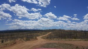
The Crags
The Crags trail is one of my favorites in the region because of the views that can be seen from the top. When looking at Pikes Peak from Woodland Park the Crags are the jagged rock formations that can be seen on the far west side of the mountain range.

The Crags area has plenty of parking and options of trails. Hikers can choose to stay straight on the Crags trail and go to the lookout point on top of the rocks after a grueling uphill trek. Or, those looking to be more adventurous can take the trail to the right that leads up Pikes Peak to Devil’s Playground and then to the summit.
Woodland Park’s Red Rocks
When most say they are going to “Red Rocks” they are usually talking about either going to the amphitheater located west of Denver or the open space area on the west side of  Colorado Springs. However, most locals know that there are beautiful red rock formations right here in Teller County north of Woodland Park off of Highway 67.
The area can be accessed by turning right at the intersection where the Lion’s Camp is on the left side of the highway. The road brings hikers to a large parking lot where the trail starts that leads up to the rocks.
Hikers can then choose to climb on one of the three giant red rock formation or keep going on the trail that takes trekkers further into the mountains where smaller rock clusters can be seen. On the top of the rocks gorgeous views of Pike’s Peak and Devil’s Head Mountain can be enjoyed.


