Hazardous fuels reduction treatments to begin this fall
United States Forest Service
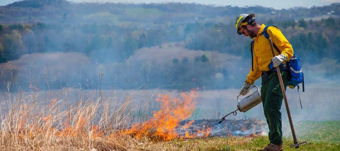
Fire managers on the Pike-San Isabel National Forests & Cimarron and Comanche National Grasslands are planning prescribed fire operations this fall, pending all required approvals. A number of slated areas include sections in Teller and Park counties, and the lower Ute Pass that could see hundreds of acres treated.
This work will continue through the fall as weather, fuel and air quality conditions allow. Fire managers prepare the project areas and monitor conditions leading up to and during implementation and may postpone or cancel prescribed fires if conditions are unfavorable. The forest and grassland website, Facebook and X will provide project-specific notifications before any planned prescribed fire activities. Prescribed fires planned include the following:
o Phantom Creek, 3,066 acres—about 6 miles north of Divide in Teller County
o Mothball Springs, 985 acres—about 4 miles northeast of Woodland Park in El Paso County
o Manitou, 266 acres—about 2 miles southwest of Green Mountain Falls in El Paso County
o Peregrine, 270 acres—about 2 miles southwest of Green Mountain Falls in El Paso County
o Black Mountain, 500 acres—9 miles north of Gardner in Huerfano County
· South Park Ranger District
o Road Gulch, 1,470 acres—near Praise Mountain and County Road 98 in Park County
o Obrien, 901 acres—about 5 miles southwest of Lake George in Park County
· South Platte Ranger District
o Green Mountain, 654 acres—near Buffalo Creek Recreation Area and Forest Service Road 550 in Jefferson County
o Harris Park, 596 acres—near Harris Park, Elk Creek Highlands and Forest Ridge communities in Park County
o Payne Gulch, 331 acres—south of Bailey along County Road 64 in Park County
· Salida Ranger District
o North Trout Creek, 1,200 acres—about 6 miles west of Buena Vista in Chaffee County
o Threemile Creek, 500 acres—about 13 miles northwest of Salida in Chaffee County
· Cimarron and Comanche National Grasslands
o Cottonwood, 2,553 acres—6 miles north, northwest of Wilburton, Kan., in Morton County


