


Fire Bans Remain In Place; Extended Forecasts Call for Wet Spring
Trevor Phipps
Local residents always face a conundrum this time of year with the weather, as summer is right around the corner and cabin fever sizzles big-time.
You have that inkling to get out and enjoy the outdoors. But dire weather forecasts force you to keep the golf clubs in the closet or for your fishing rod to continue gathering dust. But with a lingering drought, you can’t complain about an occasional blast of the white stuff, even in mid-May.
However, as is often the case this time of year, our acclaimed TV weather forecasters didn’t get it right and succeeded in scaring residents regarding a would-be devastating storm. And worse of all, our drought conditions hardly changed.
For two consecutive weeks, residents thought that our mild winter streak was finally ending and we would receive a reprieve with a huge snow blast. However, the massive snowstorms predicted never occurred. As a result, we will have to deal with frequent red flag warnings and ongoing concerns about wildfires this spring and early summer.
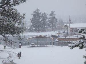
Just before May, a storm struck the area that meteorologists predicted would bring more than a foot of snow. The result was less than three inches sticking anywhere to the ground.
Schools were shuttered on April 30 since everyone thought massive snow totals were on their way. The heavy snow did cause frequent power outages and internet problems. But that was about it.
Then last week, another storm was forecasted to strike the state starting on Cinco de Mayo day. The forecast again predicted 8 to 14 inches of snow to hit the Ute Pass region. The snow was supposed to start last Tuesday (May 5) and continue until Wednesday night.
The most recent storm did prove to be more fruitful for the state. But the estimated totals for the Pikes Peak region were once again way off.
The storm, however, did hit other parts of the state hard. Areas in northern Colorado did receive over a foot of snow.
Estes Park emerged as the state’s snow champ. The town on the border of Rocky Mountain National Park clocked in 28 inches that accumulated last Tuesday and Wednesday. Meeker Park and Allens Park south of Estes also got around two feet of snowfall.
Southern Colorado, though, missed the brunt of the storm and were spared what forecasters called a major spring blast.
Areas in Denver showed more snow accumulation than the Pikes Peak region with five inches. Parts of Lakewood and the western part of the metro got as many as eight inches.
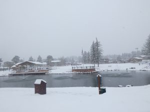
Most of Colorado Springs only received around two to four inches of snowfall. Further up into the mountains, Teller County got a little more but not much. Official snow totals put Woodland Park at four and half inches.
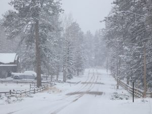
The snow did start to fall on May 5 like the forecasters promised. But it was intermittent during the two-day stretch, and much less than earlier predictions.
The Woodland Park School District did close on Wednesday due to the forecasts. But since the ground wasn’t very cold due to warm days leading up to the storm, the snow didn’t stick. As a result, RE-2 District students basically got a complete day off.
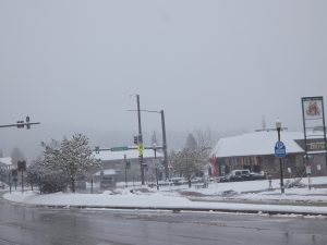
On the upside, there were no power outages for this storm. By the morning of May 6, it seemed that the snow that did fall had trouble sticking to the roads.
Around Woodland Park, the roads were clear and just wet by mid-morning. Some commuters did say though that the highway was treacherous coming through Divide earlier Wednesday morning. However, there were no reports of any significant accidents.
Chances of High Precipitation Looming
Ever since fires struck areas around Fort Carson in March, Teller County has been placed on a Stage 2 fire ban. As a result, almost all outdoor fires are prohibited, and smoking outside is not permitted. Stage 2 is a rather serious designation, amounting to one step short of a complete shutdown of key recreation spots.
The area did receive some much-needed moisture, but not enough to move the drought needle by any significant measure. After the two snowstorms, county officials met to discuss the fire ban, and they chose to keep it implemented.
After the snow hit last week, the weather did warm back up. A few days of summer-like sunshine once again struck up fears of high fire danger this summer. But that scenario could change this week.
After a brief dry spell in early March, the weather forecast hinted that Mother Nature could be making a 180-degree turn. According to extended forecasts available online, there is a chance of a few rainy days this week. But it depends on which site you believe.
AccuWeather’s 30-day forecast includes a mix of rainy/cloudy days and sunshine. The site says the trend of off and on rain should continue throughout most of May.
MyForecast.com, however, tells a different story. MyForecast’s 30-day forecast shows a chance of clouds, rain and thunderstorms every day from this week until June.
For years many have trusted the Old Farmer’s Almanac when it comes to long-term weather predictions. The Farmer’s Almanac 60-day forecast shows that scattered thunderstorms are possible from this week until the end of May. The Almanac predicts that the chances of daily thunderstorms will stay high through the first couple weeks of June.
So, if the forecasters are correct for once, the Ute Pass region could experience a wet late spring and early summer season after a dry winter. Hopefully, Mother Nature will find a way to balance herself out and prevent wildfires from igniting this summer.


